
It is 1725. The freshly forged and heavily reformed Russian Empire sets on the assertive course to level with the leading European powers by all means. The “Window to the West” was finally opened, and the newly built capital of St. Petersburg was on its way to prosperity. After the prodigious military expansions of Great Northern War, it was now the time to expand the Empire eastwards. Shortly before his death, Russian Emperor Peter The Great drafts an order to arrange the first official expedition east of Siberia - and so began the journey into the unknown.
Here, Sergey Lutsenko explains how Vitus Jonassen Bering led multiple expeditions to the Russian Far East – and managed to ‘discover’ Alaska for Russia.
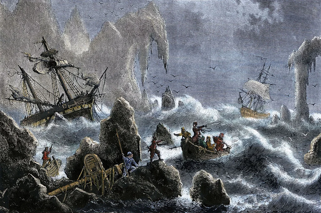
A depiction of the wreckage of Vitus Bering's 1741 expedition in the Aleutian Islands .
First Kamchatka Expedition
Vitus Jonassen Bering (1681-1741), himself a Dane, serving in the Imperial Russian Navy-was instructed and provided means to sail the dark and treacherous waters of the North Pacific in order to find out, in the Emperor’s words, “where Asia conjoins America” and identify the presence of any European settlers in the area. It was a cold February 1725 when Bering’s expedition set out from St. Petersburg towards Okhotsk- the main Russian naval base on the coast of the Pacific. By way of land, river and snow the experienced crew of 24 members made its way through more than 5,500 kilometers of Russian mainland passing Vologda, Irkutsk and Yakutsk. It took them 2 years to finally reach their destination. The Emperor ordered Bering to build two deck ships to transport the members of the expedition, but Bering had cleverly instructed one of them to be constructed well in advance before his arrival. The second ship was brought to the dock of Okhotsk, repaired and equipped in time as well. Having waited the winter in Okhotsk, Bering set sail onboard his newly built “Fortuna” in the direction of Kamchatka. Ironically, after a week at sea, a misfortune occurred - leakage was spotted and the crew had to urgently dock and unload their vessels. Not willing to lose time and resources in the field, Bering decided to move by land to the staging post- naval base Nizhnekamchatsk, where another ship – “St. Gabriel”- was built. It was onboard that ship, after a year of delay, that the expedition finally set sail towards the edge of the world.
On August 11, 1728, Bering entered a narrow passage, which separated Asia from America. Some decades after, despite the fact that Bering was not the first to cross it, the strait would be designated by James Cook and up to this day bears the name of “Bering Strait”. Two days later, with strong northern winds, the expedition crossed the Arctic Circle. At this point Bering decided that his mission was complete - it was evident to him that the American shore had no connection to Asia. The crew returned to Kamchatka.
After additional efforts to discover a land bridge, Vitus Bering and his crew returned to St. Petersburg. The crew of the expedition received high honors, with Bering himself promoted to the rank of Captain Commander. Even though the First Kamchatka Expedition did not manage to “discover” America, it was an invaluable contribution to the cartography and ethnography of the region. Shortly afterwards, the preparations for the second, much more ambitious expedition began.
Great Northern Expedition (Second Kamchatka Expedition)
Vitus Bering had accomplished his mission in mapping the region; however his achievements were not enough to satisfy the interests of either Russian Governing Senate or the main sponsor of the expedition - the Admiralty. In order to save his reputation, without hesitation he proposed that he should arrange a second expedition. After a delay caused by a major succession crisis within the Russian monarchy, orders were issued by the Imperial Senate under the imprint of Empress Anna Ioannovna.
The expedition was complex and exceptionally expensive by the standards of the 1740s - the estimated expenditure reached a tremendous 1.5 million rubles. This was nearly one sixth of the Russian Empire’s yearly income. The aims included determining the existence of the north-east passage between Europe and the Pacific, the charting of the Arctic coast, extensive mapping of Eastern Siberia, and voyages into Japan and America in order to establish commercial relations. The wider scale of the second expedition can be also seen through the decision to involve members of the Academy of Sciences, founded in 1724. Three professors, accompanied by a team of five students, two landscape artists, an interpreter, a physician, and an instrument-maker were appointed to undertake scientific research throughout the journey. Apart from observations of flora and fauna, scholars were instructed to record customs, habits and behavior of indigenous people.
The expedition left St. Petersburg in three stages; the first, led by Commander Bering, was to proceed to Kamchatka via Okhotsk, and from there further north, to explore the area where the mythical “Joao-da-Gama-Land” was said to be located. Joao da Gama was a famous Portuguese explorer who claimed the discovery of a massive landmass north of Japan back in 1589. Since then, nobody had confirmed his claims. A second group, led by Bering’s second-in-command, Danish captain Martin Spangberg, was headed to China and Japan and a third group was the above-mentioned academic component, on their own separate itinerary. Each of the three groups made significant discoveries, but it is Bering’s story that we are going to follow.
En route to the Unknown
On September 8, 1740, the packet boats “Sv. Piotr” under Bering’s command and “Sv. Pavel”, captained by Alexei Chirikov - who accompanied the first expedition - left the port of Okhotsk towards Kamchatka. They sailed through the passage between the southernmost tip of Kamchatka and the northernmost of the Kuril Islands, and neared their destination by September 27. However, heavy weather and fog forced them back into the sea. It was only on October 6 that the ships entered Avacha Bay, to start building their winter settlement. The settlement was named “Petropavlovsk”, to glorify the names of the saints as well as the first ships to enter. The city later grew to become the capital of Kamchatka peninsula- Petropavlovsk-Kamchatskiy.
Having waited the winter, the crew decided, after some deliberations, to proceed southeast, where, according to their calculations, “Joao-da-Gama-Land” was located. Early in the morning on June 4, both ships left Avacha Bay. The plan was to return by the end of September, but that was never to happen. Having reached the approximate location of the mythical landmass, the officers of the expedition concluded that it never existed, and their efforts were in vain. Both ships turned north.
Sailing conditions were harsh, with frequent storms and thick fog. Despite shooting cannons and ringing bells, the captains lost sight of each other. After three days of unsuccessful attempts to meet, Bering ordered his ship to sail north, while Chirikov headed northeast. The crew of Sv. Piotr spent a long and troublesome four weeks at sea. Storms raged on; thirst, hunger and scurvy devastated the crew.
Captain Bering fell sick. The spirit of desperation began to haunt the sailors, and the bitter end seemed inevitable. Miraculous it was, when on July 16, 1741, the members of the expedition sighted high mountain peaks, covered in snow. They had reached the shores of Alaska. Sv. Piotr continued to sail along the coast and on July 20 anchored near a large island near the mainland. Two teams were sent to scout for fresh water and a more suitable bay to disembark. Upon their return, scouts reported that they had found a good area to dock as well as signs of a small local settlement in the area. At this point Bering was too weak to walk. He instructed the ship surgeon and naturalist Georg W. Steller to explore the island and record his observations. Having spent 10 hours ashore, Steller studied the indigenous settlement and observed local flora and fauna. His efforts were amongst the first European contributions to the natural and human history of the region. The crew refilled their supplies of fresh water, and at 6AM the next day set sail again. They designated the area as “Cape Saint Elias”, which later came to be known as Kayak Island, 250 miles southwest from modern day Anchorage.

A map from the 1770s showing the Russian Discoveries.
First Contact and Bering’s Bitter End
The expedition continued to explore the area, but the conditions onboard worsened dramatically. Scurvy now affected almost every sailor, the fresh water supplies were never enough, and Bering’s health deteriorated. The crew went ashore on the archipelago, which was named Shumagin Islands, honoring the first sailor who died from scurvy - Nikita Shumagin. Heavy storms forced a delay but it was these circumstances that allowed for the first European contact with the Aleuts, an indigenous group, to be established. When the storms calmed, Bering decided upon a return to Kamchatka. The way back was more devastating than ever; scurvy ravaged the crew again. St. Peter drifted until November 4, when mountain peaks were spotted again. The ship approached land around nightfall, to face strong winds; attempts were made to anchor close by shore, but the waves broke the anchor chain and the ship was thrown over the riffs, suffering heavy damage. Nevertheless, the crew managed to anchor in a small bay. Over the course of two weeks, sailors who could walk transported their sick ship-mates ashore. Nine died. Bering was sure that they landed on Kamchatka, but after his scouts returned the last hope was gone - they were on an unknown, uninhabited island. There was no choice but to wait the winter. The landscape was mostly covered with snow, with a small freshwater river providing the only source of life. No forest grew next to the shore. Survivors had to winter in dugouts, covered with tarpaulin.
Commander Vitus Jonassen Bering, the legendary captain and leader of the North Pacific expedition, and the man who led an expedition to set foot on Alaska, died on December 19, 1741. The island where he died was later named in his honor - Bering Island, just like Bering Sea, Bering Glacier and Bering Land Bridge. His achievements, however, are subject to debate. He was neither the first Russian to sight Alaska, nor the first to enter the Bering Strait. Nevertheless his efforts to make the first contact with the Aleuts on top of his other exploration endeavors are considered substantial contributions to naval mapping, ethnography, and geography.
What do you think of Vitus Jonassen Bering’s legacy? Let us know below.
References
J. L. Black, "G.-F. Müller and the Russian Academy of Sciences Contingent in the Second Kamchatka Expedition, 1733-43." Canadian Slavonic Papers 25, no. 2 (1983): 237, 239
Raymond H. Fisher, “Berings Voyages: Whither and Why. Seattle, WA: University of Washington Press”, 1977. 17-19
Wieland Hintzsche, Thomas Nickol. "Die Grosse Nordische Expedition: Georg Wilhelm Steller (1709-1746)." The Geographical Journal 164, no. 2 (1998): 200
Sven Veksel’, Vtoraja Kamchatskaja Ekspedicija Vitusa Beringa, Glavsevmorputi, 1940: http://az.lib.ru/w/wakselx_s/text_1759_vaksel_kamchatka.shtml
Velikaya Severnaya Ekspedicija: Vtoraja Kamchatskaya Ekspedicija Beringa (article by Diletant Media): posted 15 June 2018: http://diletant.media/excursions/29368005/