In the winter of 1835, two US states (one a territory, actually) almost went to war over the city of Toledo, Ohio.
The Toledo War of 1835-36 was a bizarre and largely forgotten footnote of American history over control of the ‘Toledo Strip,’ a 468 square mile band of land between the borders of the state of Ohio and the then Michigan Territory.
Randy Griffin explains.
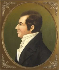
Former Ohio governor and US Surveyor General Edward Tiffin.
Where is Lake Michigan?
What was to become known as the Toledo War had its beginnings before the country itself.
In 1787, the Congress of the Confederation (the legislative body created from the Articles of Confederation that governed from March 1, 1781, to March 3, 1789) enacted the Northwest Ordinance.
The Northwest Ordinance specified that the Northwest Territory, the 260,000 square miles surrounding the Great Lakes, would be divided into ‘not less than three nor more than five’ states, with one of the boundaries being ‘an east and west line drawn through the southerly bend or extreme of Lake Michigan.’
The Enabling Act of 1802 gave Ohio permission to begin the process of statehood, stating that the border of the new state would be ‘an east and west line drawn through the southerly extreme of Lake Michigan, running east...until it shall intersect Lake Erie or the territorial line [with British North America], and thence with the same through Lake Erie to the Pennsylvania line aforesaid.’
Surveyor John Mitchell’s map, called the ‘Mitchell Map,’ considered the best map of the time, showed the southern extreme of Lake Michigan north of the mouth of the Detroit River. By mistakenly placing Lake Michigan’s southern tip several miles north of its true location, the Mitchell Map made it seem like the east-west line would not meet Lake Erie at all, the original border placed at the mouth of the Manumee River and Toledo in northern Ohio rather than in southern Michigan Territory.
When Ohio drew up its constitution of 1802, it was with the assumption that Congress intended that the northern Ohio boundary would be north of the Maumee River, maybe even the Detroit River. Ohio claimed most of the shoreline west of Pennsylvania, leaving future states with access to only Lakes Michigan, Huron, or Superior.
All well and good for Ohio. But when a fur trapper (whose name is lost to history) reported that Lake Michigan actually lay significantly further south than believed, Ohio delegates realized they might not only lose out on prime shore front, but could be denied the entire shoreline west of Pennsylvania.
With this in mind, the constitutional delegates hedged their bet, inserting a provision into the Ohio constitution that if the fur trapper was correct, the state’s boundary line would be adjusted to meet with Lake Erie at the ‘most northerly cape of the Miami [Maumee] Bay,’ guaranteeing that most of the southern shore of Lake Erie west of Pennsylvania would go to Ohio.
The draft constitution was sent to Congress and referred to a committee, where politicians do what politicians best (namely, kick the can down then road) deciding that since the exact whereabouts of Lake Michigan were yet to be determined the members ‘thought it unnecessary to take it [the provision], at the time, into consideration,’ and on March 1, 1803 Ohio became the 17th state, the first formed from the Northwest Ordnance.
In 1805, Congress created the Michigan Territory, again using the Northwest Ordinance’s definition to define the territory’s southern boundary, ambiguity and all. And although the Ohio legislature spent the early part of the 19th century repeatedly asking Congress to resolve the issue, differences with Ohio’s border version went unresolved for 30 years.
In 1812, Congress finally got around to approving a survey, but the War of 1812 delayed it. Only after the admission of Indiana in 1816 was the survey started. The results led Congress to move the border between the Michigan Territory and Indiana ten miles north to give Indiana access to Lake Michigan.
Former Ohio governor and US Surveyor General Edward Tiffin tapped William Harris to perform another survey, one that didn’t use the Northwest Ordinance line but the one specified in the Ohio constitution.
When the results of the Harris survey, which obviously favored Ohio’s claims, was made public, Michigan Territory Governor Cass cried foul, saying the survey favored Ohio and that it ‘is only adding strength to the strong, and making the weak still weaker.’
Of course, the Michigan Territory commissioned its own survey, led by John A. Fulton, one based on the Northwest Ordinance Line. His survey found the boundary ending just southeast of the Maumee River.
This discrepancy between the Harris and Fulton survey lines was eight miles apart at Lake Erie and five miles apart at the Indiana border, resulting in a 468-mile piece of land known as the ‘Toledo Strip.’
Taking the initiative, Michigan quietly occupied the strip, setting up a local government, infrastructure and, most importantly, collecting taxes.
By the early 1820s, Michigan had reached the 60,000 population threshold to become a state. Here politics became involved, as the Ohio Congressional delegation flexed its political muscle in Washington to block Michigan’s admission to statehood, resulting in Congress denying their right to hold a state constitutional convention in 1833 because of the Toledo Strip controversy.
In January 1835, 27-year-old Michigan Territorial Governor Stevens T. Mason (nicknamed the ‘Boy Governor’) took matters into his own hands, calling for a constitutional convention in May, regardless of what Ohio and Washington wanted.
In February 1835, Ohio began setting up a county government in the Strip, naming the county where Toledo would be as Lucas County, after Ohio governor Robert Lucas.
Michigan Territorial Governor Mason responded by signing the Pains and Penalties Act six days later. According to Michigan law, it was now a criminal offense for Ohio to perform government actions in the strip. The Ohioan offenders could be arrested and face up to a $1000 fine ($30,000 in 2024 money) and up to five years of hard labor, or both, without benefit of trial.
Governor Mason appointed Brigadier General Joseph W. Brown of the Third US Brigade to command the state militia, with orders to be ready to act against trespassers.
Escalation
On March 31, 1835, Ohio Governor Lucas, along with General John Bell and approximately 600 militiamen, made their to Perrysburg, Ohio, ten miles southwest of Toledo.
A few days later, Governor Mason, General Brown, and 1,000 men arrived in Toledo to stop Ohio from moving further into the area and marking the border in their favor.
By now, the border dispute had the full attention of Washington. President Jackson consulted his Attorney General Benjamin Butler, who believed that until Congress deemed otherwise, the strip was a part of the Michigan Territory.
But by now it was a political, not legal, issue.
Ohio at the time had 19 representatives and two senators, while Michigan, as a territory, had just one non-voting delegate. Then, as now, Ohio was considered a swing state, and the Democratic Party simply couldn’t afford to lose Ohio’s electoral votes.
Therefore, Jackson decided that the Toledo Strip would be part of Ohio.
Jackson sent two representatives, Richard Rush of Pennsylvania and Benjamin Chew Howard of Maryland, to Toledo to mediate the conflict and offer a compromise: another survey to mark the ‘Harris Line,’ and that the residents of the region could decide for themselves which state or territorial government they wanted to live in.
Governor Lucas reluctantly agreed and began sending his militia home. Governor Mason refused the compromise and kept his militia together and ready for conflict.
During the elections, Ohio officials found themselves harassed by Michigan officials, the residents threatened with arrest if they went along with Ohio authority.
Battle of Philips Corners
Two days after the April Michigan election, Ohio Governor Lucas sent out a team of surveyors led by Uri Seely of Geauga County, Jonathan Taylor of Licking County, and John Patterson of Adams County, to mark the Harris Line.
On Sunday, April 26 April 1835, Michigan General Joseph Brown and 60 militiamen surprised the survey party. In the only armed incident of the war, the militia reportedly fired shots over the surveyor’s heads. The surveyors scattered, with General Brown’s militia arresting nine, charging them with violation of the Pains and Penalties Act. The authorities brought the nine to Tecumseh, Michigan, where six paid bail for release, and two were acquitted. Only one man, who went by the name of Feltcher, who stubbornly refused to pay his bail, remained in custody.
Three of the escaped surveyors made their way back to Governor Lucas at Perrysburg, where they reported that ‘nine of our men, who did not leave the ground in time after being fired upon by the enemy, from thirty to fifty shots, were taken prisoners and carried away into Tecumseh, Michigan.
Lucas called a special session, and on June 8 passed a series of laws, including making Toledo the county seat of Lucas County, the establishment of a Court of Common Pleas, a law to prevent ‘forcible abduction’ of Ohio citizens, and $300,000 ($9.6 million in 2024) to fund it.
Michigan responded with $315,000 in funding for its militia.
We are the weaker party, it is true, but we are on the side of justice...we cannot fail to maintain our rights against the encroachments of a powerful neighboring state.
While the Michigan Territory spent May and June 1835 drafting its state constitution, Congress and President Jackson were still unwilling to make Michigan a state until the border issue was resolved.
In June, Governor Lucas sent US Attorney Noah Haynes Swaye, former Ohio Governor and Congressman William Allen, and David T. Disney to Washington to plead their case to Jackson.
Throughout the middle of 1835 saw lawsuits, skirmishes, arrests, and spying on both sides to keep track of the sheriffs of Wood County, Ohio, and Monroe County, Michigan.
On July 15, 1835, Monroe County Michigan Deputy Sheriff Joseph Wood made his way to Toledo to arrest either Major Benjamin Stickney or his son Two, who were aligned with Ohio’s claim on the Strip, but ended up arresting the whole family when they resisted.
During the arrest, a scuffle broke out where Two Stickney pulled out a small penknife and stabbed Marshall Wood in the arm, the first, and only, recorded incident of bloodshed in the Toledo War. Wood survived the minor injury, and Two fled into Ohio.
Mason demanded Two Stickney be handed over to Michigan, but of course Lucas refused. Mason wrote to Jackson asking for Supreme Court intervention, but Jackson declined.
Lucas again put pressure on the Ohio delegation, and they convinced the President that the hot-headed young Michigan Territorial Governor had to go.
Jackson had appointed Mason territorial secretary at age 19. When he returned to Detroit at the end of August, Mason learned Jackson had fired him.
In one of his last acts as governor, Mason sent 1,000 militia into the Toledo Strip to prevent the first session of the Ohio Court of Common Pleas, which planned to hold court on the first Monday of September 1835. But the Ohioans wisely held a midnight session and promptly left town for Ohio.
Twenty-one-year-old J. Wilkie Moore, a part of the Michigan militia, wrote that “they had a vast amount of fun,” and that farmers along the way “welcomed us enthusiastically because we were fighting for Michigan.”
In Mason’s place, Jackson appointed John S. (‘Little Jack’) Horner, who, upon his arrival in the Territory, was pelted with vegetables, burned in effigy, and generally made to feel unwelcome in his new role.
In October, Michigan held elections, approved its draft constitution, reelected Mason governor, and sent Isaac E. Crary as the first US Representative. Congress refused to accept his credentials, and he became a non-voting delegate. The two US senators chosen by the legislature in November, Lucius Lyon and John Norvell, upon their arrival in Washington, could only sit in the spectators’ seat in the Senate gallery.
The ‘Frostbitten Convention’
Because of slavery, the Union admitted states in pairs: one slave state and one free state. Arkansas joined the Union as a slave state in 1836. Jackson wanted Michigan to offset Arkansas and signed the bill admitting Michigan as a free state if they would give up their claim to the Toledo Strip. In return, they would grant Michigan the rest of the Upper Peninsula.
Michigan held a special convention in 1837 in Ann Arbor and flatly rejected the offer. But in reality, they had little choice.
Michigan was in a terrible financial state, spending itself almost to insolvency by the funding of their militia. The US Treasury at the time gave surplus monies to the states. Washington was ready to disperse some $400,000 ($12 million in 2024 money) to the states; but territories got nothing.
So Michigan relented and held a second convention again at Ann Arbor on December 14, 1836. Known as the ‘Frostbitten Convention,’ Michigan accepted Congress’ terms, and on January 26, 1837, Michigan was admitted as the 26th state.
Afterwards
At the time, the newly minted Michiganders felt themselves sorely used, losing the prime Toledo Strip for the 9,000 square miles of the Upper Peninsula, an area described by the Detroit Free Press at the time as a ‘barren wasteland of perpetual snows.’
But things have a way of working out, and it certainly did for Michigan. In the 1840s, copper was discovered on the Keweenaw Peninsula and iron found in the Central Upper Peninsula, spurring a mining boom that lasted well into the 20th century.
The borders between Michigan and Ohio changed over the years, and another survey in 1915 altered the line slightly, which both sides accepted.
In 1973, the Supreme Court, with Michigan v. Ohio, adjusted the border in Lake Erie slightly to the northeast, making Turtle Island, just outside Maumee Bay and originally solely Michigan’s, split between Michigan and Ohio.
Steven Mason was elected the first governor of Michigan in 1840. At 24, he holds the record as the youngest state governor in American history.
In 1841, he moved to New York City, where his wealthy father-in-law, Thaddeus Phelps, lived. There he tried to establish himself as a lawyer, but found little luck.
He caught pneumonia and died on January 4, 1842, at the age of 31.
Robert Lucas served as the 12th governor of Ohio from 1832 to 1836. From Ohio, he moved on to the Iowa Territory, where he was its first governor from 1838 to 1841. Here he was involved in another bloodless border dispute between the Iowa Territory and Missouri, remembered as the Honey War of 1839.
He died in Iowa, Iowa City, Iowa, on February 7, 1853, and is buried there.
Two Stickney had had a sister named Indiana Stickney, named for where her father, Major Stickney, had served as an Indian Agent.
Two Stickney’s older brother, the aptly named One Stickney, died in 1883, and was buried in Forrest Cemetery that runs along part of Stickney Avenue in North Toledo, once part of the Stickney farm. Major Stickney and Two, who died in 1862 at age 52, are also buried there.
At some point, One Stickney was dug up by grave robbers, his body eventually making it to the Toledo Medical College. One or two doctors were charged with grave robbing, but not much came of it, history not remembering how it turned out.
Replacing the popular Mason put John Horner in a hard position, but he made the best of it by persuading both sides to remain calm until Congress could settle the border dispute.
After the crisis, Horner left Michigan for the Wisconsin Territory, serving as the territory's secretary from 1836 to 1837.
There he stayed, becoming one of the original settlers of present-day Ripon, Wisconsin, and establishing Ripon College in 1851.
He died on February 3, 1883, in Ripon at the age of 80, and is buried in the local Hillside Cemetery.
His home, known as the John Scott Horner House, is on the National Register of Historic Places.
It is alleged that there was one fatality of the Toledo War, that being a horse belonging to Lewis E. Bailey of Michigan.
Much like the Toledo War, the particulars of how the horse met its end, history has forgotten.
You can read more from Randy here.